Put your data in Evidence
MapEvidence creates interactive maps for all data that contains geographical informations (address, city, zip code, state, country) and for all types of organizations.
MapEvidence helps you make informed decisions!
-
Companies :
Quickly find the locations of your customers, prospects, suppliers and competitors.
-
Real Estate :
Locate properties for sale or available to rent and discover their surroundings.
-
Studies and researches :
Visualize your data on a map for better analysis.
Create maps in seconds
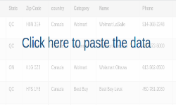
Copy your data from Excel and paste it into the space provided. Be sure to include the fields (street number, city, province, zip code and country) in the headers of your file. You can also add your own fields.
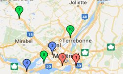
Get an interactive map from your data. The table that contains your data will be displayed below.
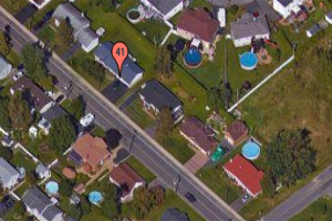
Use the satellite mode for a real visualization of the locations around your markers.
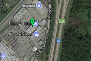
Use hybrid mode for combined visualization between street and satellite modes.
Create up to 6 different categories (groups) with your data for an enhanced visualization and analysis.